


Garmin BlueChart g2 Vision Southern Bahamas Saltwater Map microSD Card
Hurry only 1 left
Smart shoppers OnBuy it!
- Earn Cashback on every purchase – spend it instantly on your next order
- Free delivery – on millions of items across the site
- Customers love us – 139,000 Trustpilot reviews and an 'Excellent' rating
Interest-free payment options available


See full product description & details
Delivery: Standard (Free) | Tue 1st - Sat 5th Dec
Returns: 30 days
180-day payment protection
You might also like


Summary
- Realistic navigation features showing everything from shaded depth contours and coastlines to spot soundings, navaids, port plans, wrecks, obstructions, intertidal zones, restricted areas, IALA symbols and more
- Smooth display presentation including seamless transitioning between zoom levels and more continuity across chart boundaries
- Safety shading allows user to enable contour shading for all depth contours shallower than user-defined safe depth
- Fishing charts to help scope out bottom contours and depth soundings with less visual clutter on the display
- Choice of standard 2-D direct overhead or 3-D "over the bow" map perspective to make chart reading and orientation easier. Also compatible with Garmin's HomePort trip-planning software.
Garmin BlueChart g2 Vision Southern Bahamas Saltwater Map microSD Card Description
Package Type:Standard PackagingSee your surroundings more clearly with BlueChart g2 data. With BlueChart g2, you'll get detailed marine cartography that provides convenient viewing of nautical content. BlueChart g2 allows you to see your vessel's precise, on-chart position in relation to naviads, coastal features, anchorages, obstructions, waterways, restricted areas and more. You will also have access to detailed mapping capabilities that include Safety Shading, Fishing Charts, smooth data transition between zoom levels, harmonious transition across chart borders, and reduction of chart discontinuities.
Details
| OPC | P6DTWF9 |
|---|---|
| Brand |

Product Images

Product Data
additional_information
| Product_Dimensions | 8 x 6 x 1 inches |
|---|---|
| Item_Weight | 1.6 ounces |
| ASIN | B00283MYLA |
| Item_model_number | 010-C0730-20 |
| Best_Sellers_Rank | #294,505 in Electronics (See Top 100 in Electronics) #353 in Marine GPS Units & Chartplotters |
| Is_Discontinued_By_Manufacturer | No |
| Other_display_features | Wireless |
| Manufacturer | Garmin |
| Date_First_Available | July 7, 2004 |
Disclaimer: The information below is provided by various external sources and should be used as a guide only.
See your vessel’s precise, on-chart position in relation to navaids, coastal features, anchorages, obstructions, waterways, restricted areas and more with this detailed marine mapping data.
- Shaded depth contours, coastlines, spot soundings, navaids, port plans, wrecks, obstructions, intertidal zones, restricted areas and IALA symbols.
- Seamless transitions between zoom levels and more continuity across chart boundaries.
- Standard 2-D direct overhead or 3-D “over the bow” map perspective for easy chart reading and orientation.
- Safety Shading* enables contour shading for all depth contours shallower than your defined safe depths.
- Fishing Charts* to scope out bottom contours and depth soundings with less visual clutter on the display.
- Plan and organize routes from your computer with HomePort™.
Coverage
Featuring data from Explorer Charts for the Bahamas
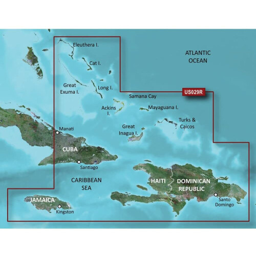
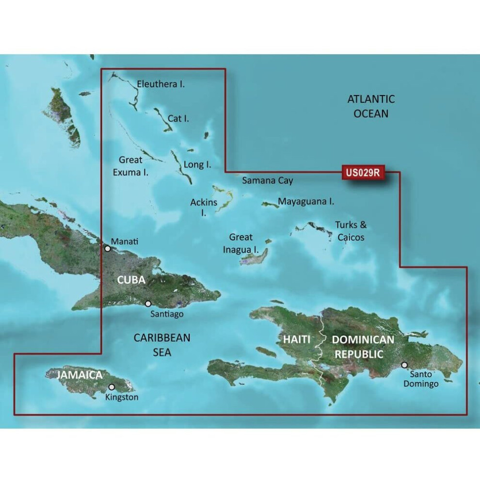
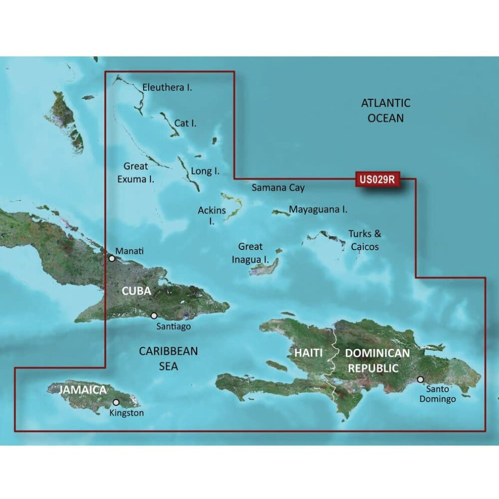
Detailed coverage from Eleuthera Island, Bahamas to the Dominican Republic including the Bahamian islands of Great Exuma, Great Inagua, Mayaguana and many others. Also includes detailed coverage of the Jamaican, Haitian, and Dominican coasts in their entirety, the easternmost quarter of Cuba, and the Turks and Caicos Islands.
Alternative names:
- Garmin 010-C0730-20 navigator map Road map
Detailed Product Information
Features
| Type | Road map |
|---|---|
| Compatibility | Alpha® Astro® Colorado® 300 Colorado® 400c Colorado® 400i Colorado® 400t Dakota® 20 echoMAP™ 43dv echoMAP™ 44dv echoMAP™ 50dv echoMAP™ 50s echoMAP™ 53dv echoMAP™ 54dv echoMAP™ 70dv echoMAP™ 70s echoMAP™ 73dv echoMAP™ 73sv echoMAP™ 74dv echoMAP™ 74sv echoMAP™ 93sv echoMAP™ 94sv epix™ eTrex Legend® HCx eTrex Vista® HCx eTrex® 20 eTrex® 20x eTrex® 30 eTrex® 30x eTrex® Touch 25 eTrex® Touch 35 eTrex® Touch 35t GPSMAP® 1040xs GPSMAP® 2106 GPSMAP® 2110 GPSMAP® 2206 GPSMAP® 2210 GPSMAP® 396 GPSMAP® 4008 GPSMAP® 4010 GPSMAP® 4012 GPSMAP® 420/420s GPSMAP® 4208 GPSMAP® 421 GPSMAP® 4210 GPSMAP® 4212 GPSMAP® 421s GPSMAP® 430/430s GPSMAP® 431 GPSMAP® 431s GPSMAP® 440/440s GPSMAP® 441 GPSMAP® 441s GPSMAP® 495 GPSMAP® 5008 GPSMAP® 5012 GPSMAP® 5015 GPSMAP® 520/520s GPSMAP® 5208 GPSMAP® 521 GPSMAP® 5212 GPSMAP® 5215 GPSMAP® 521s GPSMAP® 525/525s GPSMAP® 526 GPSMAP® 526s GPSMAP® 530/530s GPSMAP® 531 GPSMAP® 531s GPSMAP® 535/535s GPSMAP® 536 GPSMAP® 536s GPSMAP® 540/540s GPSMAP® 541 GPSMAP® 541s GPSMAP® 545/545s GPSMAP® 546 GPSMAP® 546s GPSMAP® 547 GPSMAP® 547xs GPSMAP® 60CSx GPSMAP® 60Cx GPSMAP® 62 GPSMAP® 6208 GPSMAP® 6212 GPSMAP® 62s GPSMAP® 62sc GPSMAP® 62stc GPSMAP® 64 GPSMAP® 640 GPSMAP® 64s GPSMAP® 64st GPSMAP® 720 GPSMAP® 720s GPSMAP® 7212 GPSMAP® 7215 GPSMAP® 740 GPSMAP® 740s GPSMAP® 741 GPSMAP® 741xs GPSMAP® 7607 GPSMAP® 7607xsv GPSMAP® 7608 GPSMAP® 7608xsv GPSMAP® 7610 GPSMAP® 7610xsv GPSMAP® 7612 GPSMAP® 7612xsv GPSMAP® 7616 GPSMAP® 7616xsv GPSMAP® 76CSx GPSMAP® 76Cx GPSMAP® 78 GPSMAP® 78s GPSMAP® 78sc GPSMAP® 8208 MFD GPSMAP® 8212 MFD GPSMAP® 8215 MFD GPSMAP® 840xs GPSMAP® 8500 Black Box GPSMAP® 8530 Black Box Montana® 600 Montana® 600t Camo Montana® 610 Montana® 610t Camo Montana® 650 Montana® 650t Montana® 680 Montana® 680t Monterra™ nüvi® 500 nüvi® 550 Oregon® 200 Oregon® 300 Oregon® 400c Oregon® 400i Oregon® 400t Oregon® 450 Oregon® 450t Oregon® 550 Oregon® 550t Oregon® 600 Oregon® 600t Oregon® 650 Oregon® 650t Rino® 520HCx Rino® 530HCx Rino® 650 Rino® 650t Rino® 655t Volvo Penta Glass Cockpit System |
| Geographic coverage | Southern Bahamas |
Customers also buy
Compare Sellers for Garmin BlueChart g2 Vision Southern Bahamas Saltwater Map microSD Card
- New from £291.99
| Seller | Ratings | Warranty | Returns | Price | Delivery | Total | Quantity |
|---|---|---|---|---|---|---|---|
|
Dispatched from:

|
(54 reviews) | - |
30 Days
Free Returns No
|
£291.99
|
+Free Delivery
Est. Delivery:
1st-5th Dec
|
£291.99
|
Earn as you shop with instant Cashback on everything.
No catch, no cost
- Paid into your OnBuy account
- Spend it on your next purchase
- Save it or withdraw it
Become a Cashback VIP
Just 1 purchase unlocks bigger deals & rates