





















Garmin Vus512l Mid Atlantic Bluechart G2 Vision "Product Category: Cartography - Garmin/Bluechart G2 Vision Us - Microsd/Sd"
In stock
Smart shoppers OnBuy it!
- Earn Cashback on every purchase – spend it instantly on your next order
- Free delivery – on millions of items across the site
- Customers love us – 135,000 Trustpilot reviews and an 'Excellent' rating
Interest-free payment options available


See full product description & details
Delivery: Standard (Free) | Wed 7th - Fri 9th Oct
Returns: 30 days
180-day payment protection
You might also like


Summary
- New
- Same Day Shipping on Request
- Best Value and Performance in its Class
- 15-Years as premier solution provider
- Complimentary White Glove Service - Just-Ask-We-Take-Care-of-It
Garmin Vus512l Mid Atlantic Bluechart G2 Vision "Product Category: Cartography - Garmin/Bluechart G2 Vision Us - Microsd/Sd" Description
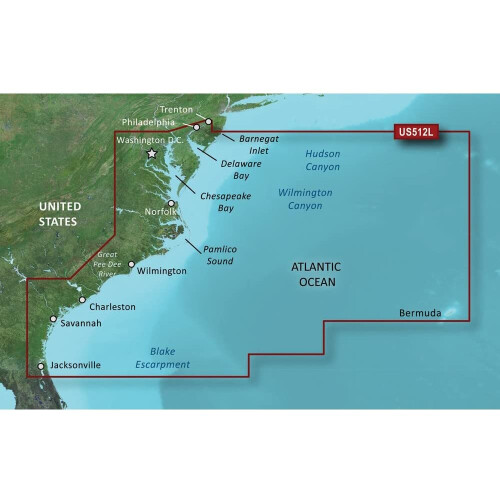
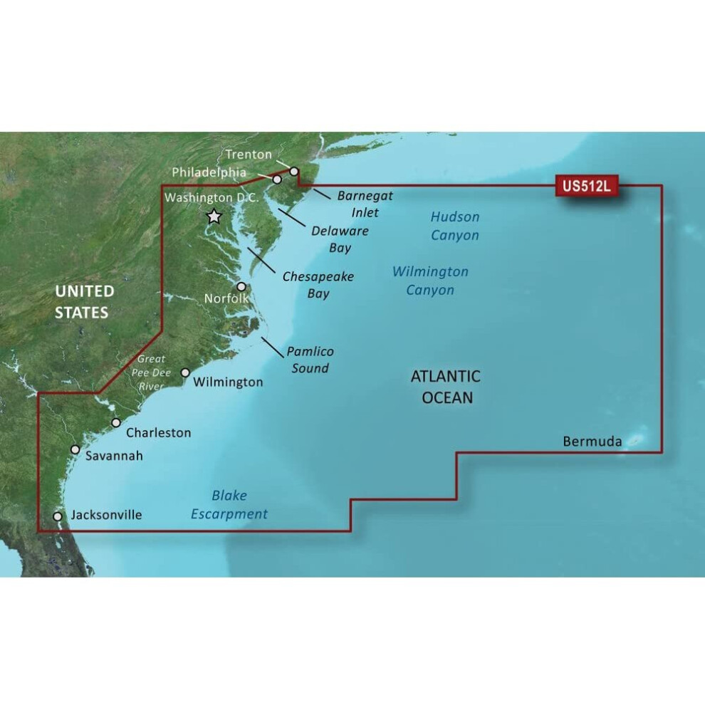
BlueChart g2 Vision HD - VUS512L - Mid-Atlantic - microSD/SDCoverage:Coverage of the east Coast from Barnegat Inlet, NJ through Jacksonville, FL, to Bermuda. Coverage includes the Delaware River to Trenton, NJ; the Chesepeake Bay in full; the Albemarle and Pamlico Sounds in full; Cape Fear, NC; the Savannah R. to Augusta, GA; and the St. Johns R. to Hastings, FL. Bathymetric coverage from Hudson Canyon to the Blake Escarpment, including the Wilmington, Baltimore and Washington Canyons, Charleston Valley, and the Savannah Seachannel.Premium Mapping and Graphics CapabilitiesDetailed nautical charts, in vector object oriented format, derived from government charts and private sources to provide port plans, depth contours, navigational aids, and tides and currents in a seamless chart presentationShaded depth contours and intertidal zones with spot soundingsAerial photos of ports, marinas, bridges and navigational landmarks and realistic "view from space" high-resolution satellite imageryUp to 1-foot HD contours provide a more accurate depiction of bottom structure for improved fishing charts and navigation in swamps, canals, marinas and port plansGarmin Auto Guidance 3.0 technology is now capable of providing routing guidance to virtually any accessible destination on the waterWorldwide coverage available in regionalized cutsBased on the standard BlueChart g2 HD features, BlueChart g2 Vision HD provides premium mapping and graphics capabilities. Plug a BlueChart g2 Vision HD card into your compatible chartplotter's microSD/SD card slot to tremendously expand its mapping capabilities. BlueChart g2 Vision HD is our premium marine cartography for use with Garmin chartplotters. It includes all the features of BlueChart g2 HD charts and adds Garmin exclusive Auto Guidance 3.0. Garmin Auto Guidance 3.0 te
Details
| OPC | P6DT8WQ |
|---|---|
| Brand | |
| Codes | 0753759069216 (EAN) |
| 0031111859225 (EAN) | |
| 0015568997105 (EAN) |

Product Data
additional_information
| Product_Dimensions | 18 x 10 x 6 inches |
|---|---|
| Item_Weight | 1.6 ounces |
| ASIN | B00P0DH424 |
| Item_model_number | 010-C0741-00 |
| Best_Sellers_Rank | #246,997 in Electronics (See Top 100 in Electronics) #292 in Marine GPS Units & Chartplotters |
| Is_Discontinued_By_Manufacturer | No |
| RAM | 4 GB |
| Other_display_features | Wireless |
| Manufacturer | Garmin |
| Date_First_Available | May 23, 2012 |
Disclaimer: The information below is provided by various external sources and should be used as a guide only.
See your vessel’s precise, on-chart position in relation to navaids, coastal features and restricted areas with premium features found in this detailed marine mapping data. Includes all of the features of our BlueChart® g2 product, plus 3-D perspective above and below the waterline, Auto Guidance, high-resolution imagery, and aerial photos of ports, harbors, marinas and landmarks.
- Shaded depth contours, coastlines, spot soundings, navaids, port plans, wrecks, obstructions, intertidal zones, restricted areas and IALA symbols.
- Seamless transitions between zoom levels and more continuity across chart boundaries.
- High resolution satellite imagery for a realistic view of the land and water.
- Aerial photos of ports, harbors, marinas, waterways, navigational landmarks and other POIs.
- Auto Guidance technology searches chart data to suggest the best passage to a destination.
- MarinerEye view 3-D perspective for a quick, easy position fix.
- FishEye view 3-D perspective for an underwater view of the sea floor.
- Safety Shading* enables contour shading for all depth contours shallower than your defined safe depths.
- Fishing Charts* to scope out bottom contours and depth soundings with less visual clutter on the display.
- Plan and organize routes from your computer with HomePort™.
Coverage
Coverage of the east Coast from Barnegat Inlet, NJ through Jacksonville, FL, to Bermuda. Coverage includes the Delaware River to Trenton, NJ; the Chesepeake Bay in full; the Albemarle and Pamlico Sounds in full; Cape Fear, NC; the Savannah R. to Augusta, GA; and the St. Johns R. to Hastings, FL. Bathymetric coverage from Hudson Canyon to the Blake Escarpment, including the Wilmington, Baltimore and Washington Canyons, Charleston Valley, and the Savannah Seachannel.
See your vessel’s precise, on-chart position in relation to navaids, coastal features and restricted areas with premium features found in this detailed marine mapping data. Includes all of the features of our BlueChart® g2 product, plus 3-D perspective above and below the waterline, Auto Guidance, high-resolution imagery, and aerial photos of ports, harbors, marinas and landmarks.
- Shaded depth contours, coastlines, spot soundings, navaids, port plans, wrecks, obstructions, intertidal zones, restricted areas and IALA symbols.
- Seamless transitions between zoom levels and more continuity across chart boundaries.
- High resolution satellite imagery for a realistic view of the land and water.
- Aerial photos of ports, harbors, marinas, waterways, navigational landmarks and other POIs.
- Auto Guidance technology searches chart data to suggest the best passage to a destination.
- MarinerEye view 3-D perspective for a quick, easy position fix.
- FishEye view 3-D perspective for an underwater view of the sea floor.
- Safety Shading* enables contour shading for all depth contours shallower than your defined safe depths.
- Fishing Charts* to scope out bottom contours and depth soundings with less visual clutter on the display.
- Plan and organize routes from your computer with HomePort™.
Coverage
Coverage of the east Coast from Barnegat Inlet, NJ through Jacksonville, FL, to Bermuda. Coverage includes the Delaware River to Trenton, NJ; the Chesepeake Bay in full; the Albemarle and Pamlico Sounds in full; Cape Fear, NC; the Savannah R. to Augusta, GA; and the St. Johns R. to Hastings, FL. Bathymetric coverage from Hudson Canyon to the Blake Escarpment, including the Wilmington, Baltimore and Washington Canyons, Charleston Valley, and the Savannah Seachannel.
Alternative names:
- Garmin Mid-Atlantic, microSD/SD Water map MicroSD/SD
- Garmin Mid-Atlantic, microSD/SD Water map MicroSD/SD
Detailed Product Information
Features
| Type | Water map |
|---|---|
| Compatibility | echoMAP™ 43dv echoMAP™ 44dv echoMAP™ 50dv echoMAP™ 50s echoMAP™ 53dv echoMAP™ 54dv echoMAP™ 70dv echoMAP™ 70s echoMAP™ 73dv echoMAP™ 73sv echoMAP™ 74dv echoMAP™ 74sv echoMAP™ 93sv echoMAP™ 94sv echoMAP™ CHIRP 42dv echoMAP™ CHIRP 43dv echoMAP™ CHIRP 44dv echoMAP™ CHIRP 45dv echoMAP™ CHIRP 52dv echoMAP™ CHIRP 53dv echoMAP™ CHIRP 54dv echoMAP™ CHIRP 55dv echoMAP™ CHIRP 72dv echoMAP™ CHIRP 72sv echoMAP™ CHIRP 73dv echoMAP™ CHIRP 73sv echoMAP™ CHIRP 74dv echoMAP™ CHIRP 74sv echoMAP™ CHIRP 75dv echoMAP™ CHIRP 75sv echoMAP™ CHIRP 92sv echoMAP™ CHIRP 93sv echoMAP™ CHIRP 94sv echoMAP™ CHIRP 95sv GPSMAP® 1020xs GPSMAP® 1040xs GPSMAP® 4008 GPSMAP® 4010 GPSMAP® 4012 GPSMAP® 420/420s GPSMAP® 4208 GPSMAP® 421 GPSMAP® 4210 GPSMAP® 4212 GPSMAP® 421s GPSMAP® 430/430s GPSMAP® 431 GPSMAP® 431s GPSMAP® 440/440s GPSMAP® 441 GPSMAP® 441s GPSMAP® 5008 GPSMAP® 5012 GPSMAP® 5015 GPSMAP® 520/520s GPSMAP® 5208 GPSMAP® 521 GPSMAP® 5212 GPSMAP® 5215 GPSMAP® 521s GPSMAP® 525/525s GPSMAP® 526 GPSMAP® 526s GPSMAP® 527xs GPSMAP® 530/530s GPSMAP® 531 GPSMAP® 531s GPSMAP® 535/535s GPSMAP® 536 GPSMAP® 536s GPSMAP® 540/540s GPSMAP® 541 GPSMAP® 541s GPSMAP® 545/545s GPSMAP® 546 GPSMAP® 546s GPSMAP® 547 GPSMAP® 547xs GPSMAP® 6208 GPSMAP® 6212 GPSMAP® 640 GPSMAP® 720 GPSMAP® 720s GPSMAP® 7212 GPSMAP® 7215 GPSMAP® 740 GPSMAP® 7407xsv GPSMAP® 7408xsv GPSMAP® 740s GPSMAP® 741 GPSMAP® 7410xsv GPSMAP® 7412xsv GPSMAP® 741xs GPSMAP® 7607 GPSMAP® 7607xsv GPSMAP® 7608 GPSMAP® 7608xsv GPSMAP® 7610 GPSMAP® 7610xsv GPSMAP® 7612 GPSMAP® 7612xsv GPSMAP® 7616 GPSMAP® 7616xsv GPSMAP® 8208 MFD GPSMAP® 8212 MFD GPSMAP® 8215 MFD GPSMAP® 840xs GPSMAP® 8500 Black Box GPSMAP® 8530 Black Box Monterra® Volvo Penta Glass Cockpit System |
| Number of users | 1 user(s) |
| Brand compatibility | Garmin |
| Distribution type | MicroSD/SD |
| Region location | North America |
| Coverage details | Mid-Atlantic |
System requirements
| Minimum storage drive space | 1.5 GB |
|---|---|
| Minimum RAM | 1024 MB |
| USB required | Yes |
| Internet connection required | Yes |
| Minimum display resolution requirement | 1024 x 768 pixels |
Compare Sellers for Garmin Vus512l Mid Atlantic Bluechart G2 Vision "Product Category: Cartography - Garmin/Bluechart G2 Vision Us - Microsd/Sd"
- New from £648.99
| Seller | Ratings | Warranty | Returns | Price | Delivery | Total | Quantity |
|---|---|---|---|---|---|---|---|
|
Dispatched from:

|
(47 reviews) | - |
30 Days
Free Returns No
|
£648.99
|
+Free Delivery
Est. Delivery:
7th-9th Oct
|
£648.99
|
Earn as you shop with instant Cashback on everything.
No catch, no cost
- Paid into your OnBuy account
- Spend it on your next purchase
- Save it or withdraw it
Become a Cashback VIP
Just 1 purchase unlocks bigger deals & rates